Description
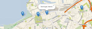
Display locations, customize the map color, choose your favorite image marker. Thanks to the use of Open Street Maps instead of Google Maps, you do not have any limits on map views, customization options and setting of markers on the map. You can add a description, photos and links to each marker.
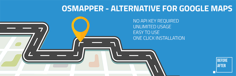
No Google Maps API keys are required to display maps. Just install the plugin and you can immediately add a map to your website.
Functionalities included in the free OSMapper map plugin:
Address geolocation
Set the marker by dragging it on the map to the right point
Set the location of the marker by providing GPS coordinates
Different color versions of maps and markers
Mobile friendly maps
No Gogole Maps API key required
Shortcodes are generating automatically
WordPress Multisite friendly
Displaying the map on many subpages
Add descriptions, links and images to your map markers
Fully new Gutenberg WordPress editor compatible
If you want you can extend the functionality of the plugin with the version OSMapper PRO :
- setting unlimited markers on one map
- unlimited number of maps
- uploading your own file as a marker on the map
- priority support
Screenshots


Installation
To install you must takes these steps
- Unzip folder with manualy downloaded plugin and upload the plugin files to the
/wp-content/plugins/directory, or install the plugin through the WordPress plugins screen directly. - Activate the plugin in the Plugins screen in WordPress
- Find in menu Maps item and click it to add a map
- After enter street name, city and zip code click Get Coordinates to fetch proper coordinates to your location
- Choose color scheme of map and map pin
- Save map!
- If system couldnt find location for your address you can drag and drop marker to proper localization. Save again!
- To place map on page copy generated shortcode which is visible on list of maps and paste to WYSIWIG editor
FAQ
-
No, it does not require it
-
No, You can display maps as many times as You want.
-
Yes, it is.
-
At this moment you can use 3 color schemes and 2 pins
-
Were using Open Street Maps to render map and leaflet.js to style it


